A Step for Titans, the East Kaibab Monocline

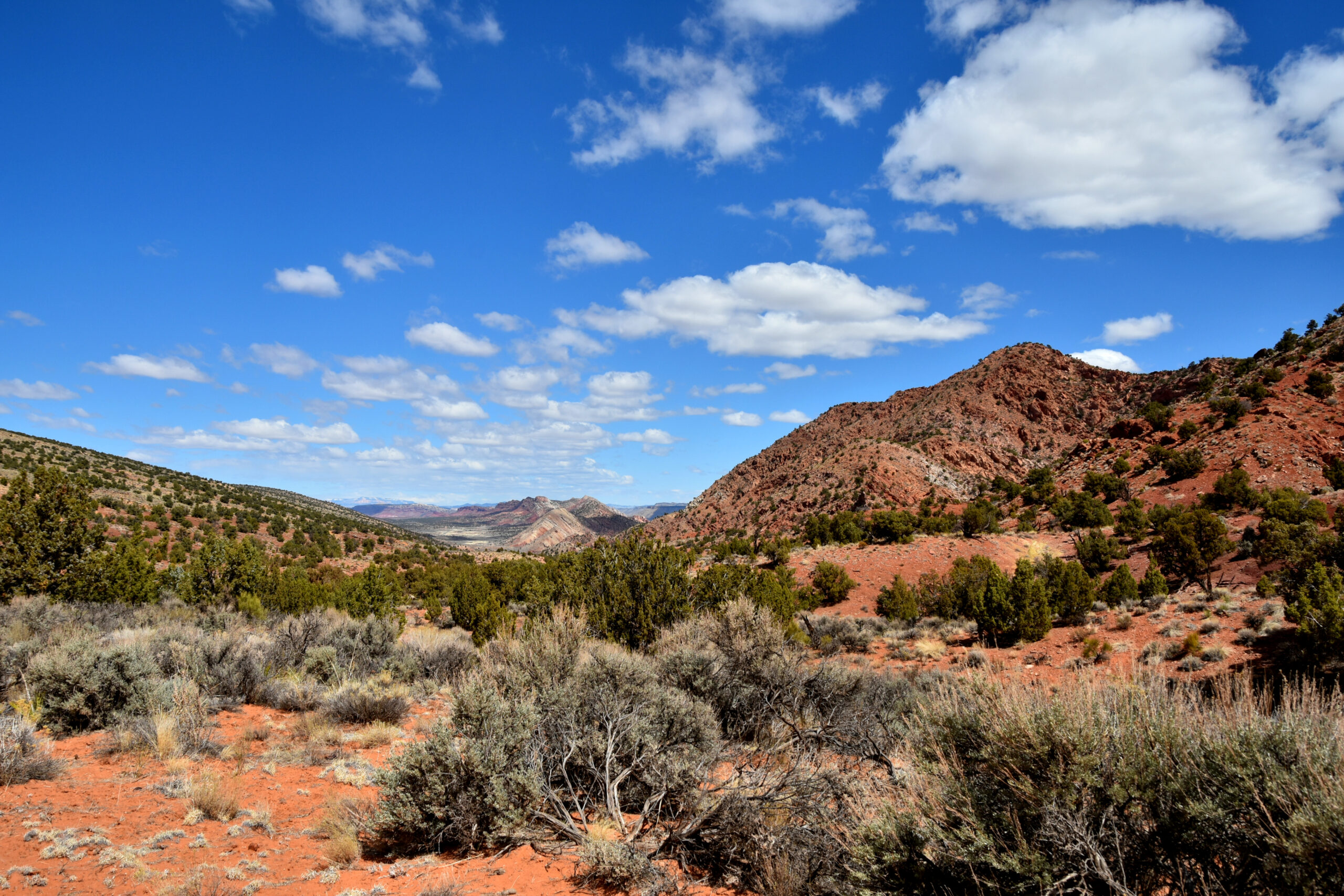
Today, I’m going to discuss one of my favorite places to see mountain building forces at work, the East Kaibab Monocline (Fig.1). It runs from the North Rim of the Grand Canyon AZ, across the border into Utah, finally flattening out near Kodachrome Basin State Park, UT. Some of the coolest things about this feature are, it can be seen from space, you can cross 150+ million years of geologic history in the rocks by walking across it, and you can drive pretty much the entirety of it! It extends for approximately 150 miles and marks the east side of the Kaibab Upwarp, a large anticline. Displacement along this fold in the rocks runs in the 3-5000 ft range, and marks where the Precambrian (older than 570 million years) basement rocks of the North American continent have been thrust upwards, folding the ductile, sedimentary layers above it.
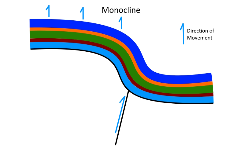
Now let’s back up a moment, and review the basic structure of a monocline. This is where a sedimentary layer or layers is stepped up or folded and flattens out again due to movement of the rocks below it (Fig. 2).

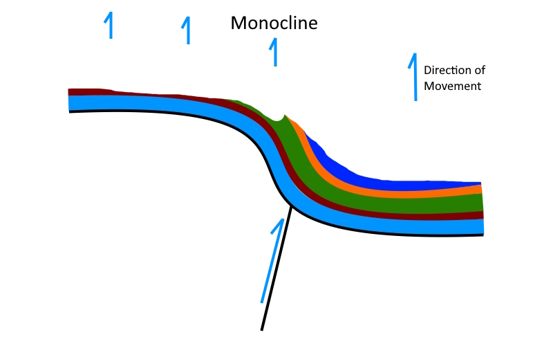
As is the case with all of the -cline family(The -Cline Family), the fold you see today was formed when these rocks where buried in a mile or more of overlying rock. Erosion is the final element in this story, as it allows for us to see the monocline in cross-section (Fig 3).

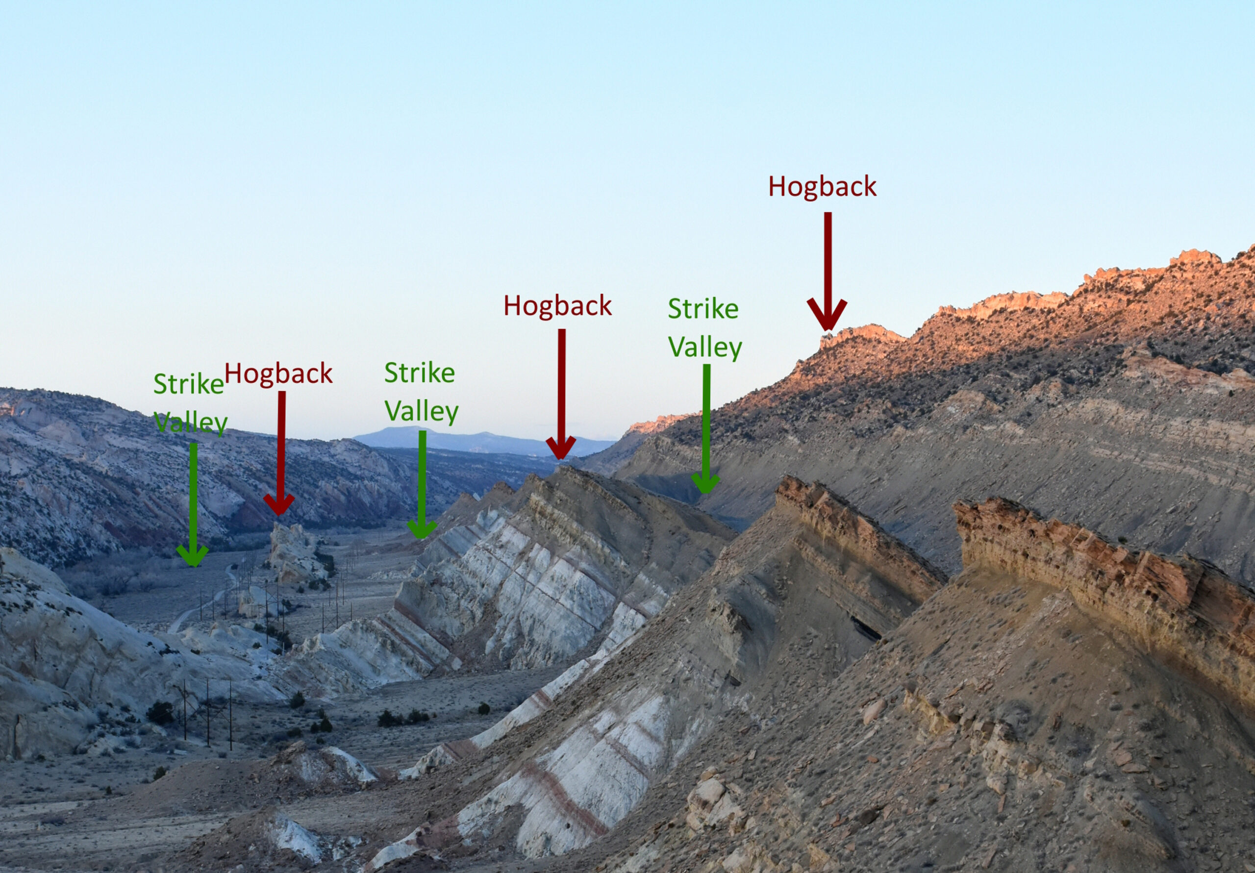
When there are layers of varying hardness in a monocline revealed by erosion, two features begin to stand out, hogbacks and strike valleys. A hogback is a ridge paralleling the monocline capped by a layer more resistant to erosion, while a strike valley forms in layers that erode more readily (Fig. 4).
Due to lack of soil and vegetation cover, these features are in full view for most of the length of the monocline (Fig. 4).

Why is it here?
The why and the how can be both simple and insanely complex, depending on how you look at it. For the last 200 or so million years, North America’s western edge has been crumpling in a collision with the Pacific Plate, and that crumpling and compression of the crust reached the area known today as the Colorado Plateau 40-70 million years ago, during the Laramide Orogeny. Orogeny is the geologic term for mountain building event, more on this in a later post. This compression fractured the hard, crystalline bedrock of the continent, forcing huge blocks of crust up and sometimes over surrounding rocks. The East Kaibab Monocline is the eastern side of one of those huge blocks, known as the Kaibab Upwarp, which is responsible for the higher elevation of the Kaibab Plateau.
Places to see the East Kaibab Monocline
- Pariah Ghost Town, Grand Staircase/Escalante National Monument, UT
- House Rock Valley Rd, AZ and UT
- The Cockscomb, UT, one of my favorite drives anywhere!
References
- Roadside Geology of Nevada, F. DeCourten and N. Biggar
- Roadside Geology of Utah, L. Chronic and H. Chronic
- Roadside Geology of Colorado, F. Williams and H. Chronic
- I’m sure an interpretive sign or two somewhere…

Zack: Simple, straight forward description and explanation of the monocline with the very clear field example of where you are. People who want more can do their own research or ask questions if they don’t know how to do that! I love it.
John